Rain water, water in lakes and rivers permeates (flow through) topsoil (aka overburden) into a permeable layer such as sandstone or shale with a lot of cracks in the underlying formations until stopped by an impermeable layer where the water cannot permeate (seep) down further and start to fill up all the cracks in the permeable layer. Between these permeable rock formations, you may get impermeable layers such as clay banks and eventually solid rock formations where the water cannot permeate further down. These water saturated layers or water “pockets” are called aquifers and may sometimes be referred to as a “lake” which is in fact water saturated rock formations.
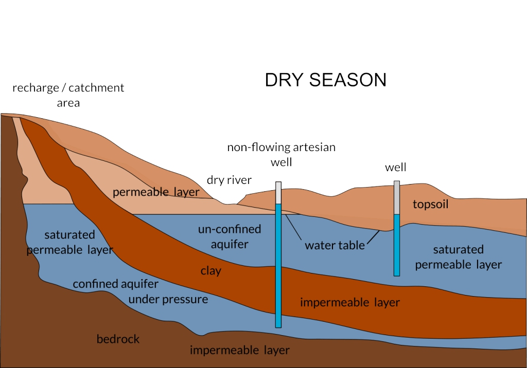
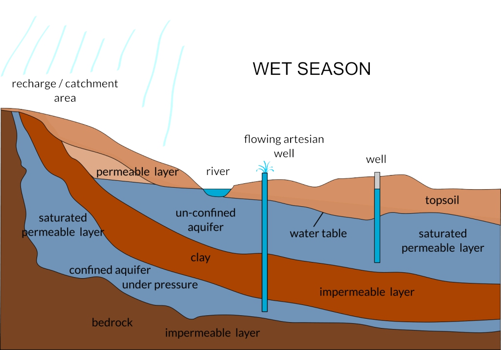
The images above describe a cross section of two aquifers, one above an impermeable layer of clay and the bottom one above an impermeable layer of bedrock. The top aquifer is fed by groundwater that permeates through topsoil or overburden and permeable layers and cannot permeates further through the impermeable clay layer. This water will continue to flow from high ground to low ground until stopped by a permeable layer or flows into a river where it will then flow into dams, lakes or the sea. This is called an unconfined aquifer meaning it is not confined to a specific area and is under no pressure – it is a free flow aquifer. To extract water from this unconfined aquifer, you need to drill a borehole well below the water table and use a pump to withdraw the water from the aquifer.
The bottom aquifer in the image on the left is fed through either a lake or rainwater in a catchment area (aka recharge area) where the water seeps through permeable layers until stopped by an impermeable layer such as solid bedrock or clay. This is called a confined aquifer and because the water can go nowhere it is regarded as under high pressure if the water level is much higher than the surrounding landscape. If you drill into such a confined aquifer which is under pressure it is called an artesian well and if the well entrance is lower than the water level of the confined aquifer, the water will free flow from the well and is than called a flowing artesian aquifer. A water spring is formed in the same way if the rock formations allows it, meaning there is a break in the confined aquifer to the overburden.
The image on the right presents a dry season or drought. The water levels may fall and the flowing artesian well may stop flowing if the water level of the confined aquifer is below the opening of the well, the same with a spring, hence to comment, “the spring has dried up”. As you will notice the river my dry up as well. If the water level of the unconfined aquifer falls below the bottom end of the well casing, you may end up with a “dry” well.
Above is a mere pinprick of information about the science of where does ground water comes from, also known as hydrogeology.